STUART LAKE (ALPINE LAKES WILDERNESS)
You may find it so hard to choose between Colchuck Lake and Stuart Lake for a day hike that you’ll need to flip a coin. Better yet, spend a weekend in Leavenworth and hike to both (or backpack).
Here are a few considerations to help you decide if you only have time to visit one of these lakes.
The trail to Stuart Lake is longer and less steep than the trail to Colchuck Lake but probably a little less crowded. Many hikers/backpackers opt for Colchuck Lake because that is a popular route into the fabled Enchantments. Writing about the Enchantments is beyond the scope of this description but if you’re interested in camping there you’ll need to make a reservation well-ahead of time.
Another consideration - Colchuck Lake is colder, deeper and the trail has more of a mountainous feel to it than Stuart Lake. Having hiked to both lakes we can attest the lakes do have different personalities. Stuart Lake is mellow and inviting; Colchuck is stunning but can also be forbidding. Both lakes are beautiful, each set within granite basins below the Stuart Mountain range.
Since summer temperatures can soar into the mid-90s we settled on Stuart Lake. Do plan an early start – we found the trailhead parking lot almost full when we arrived. Luckily, we managed to find a spot and were soon on the trail.
The trail begins in forest shady enough that twinflower and bead-lily can be found; in September you will be grateful for that shade as the trail begins to climb. Though the trail is rocky in places overall the trail is in good condition as it parallels Mountaineer Creek and easy to follow. Mountaineer Creek also plays a role in helping you stay cool on a warm day by sending you refreshing breezes along the trail.
Between sheltering pines notice where boulders have come to rest; at some point in geologic time having tumbled from ridges and peaks above. In about 0.7 miles the trail enters the Alpine Lakes Wilderness.
At about 1-3/4 miles you’ll cross Mountaineer Creek on a sturdy footbridge. Shortly after crossing the creek the trail splits (4,509 feet); continue straight for Stuart Lake (left for Colchuck Lake). Shaggy, knee-high meadows begin to alternate with pine forest and there are still plenty of wildflowers in bloom including delphinium, Indian paintbrush, asters, columbine, arnica and cow parsley.
As you hike take in dramatic views of the stark ridges above; none are within easy reach of hikers. There are also views of Argonaut Peak as you head toward the lake (though the peak is smaller it bears such a close resemblance to Mount Stuart that without a map it is easy to confuse them).
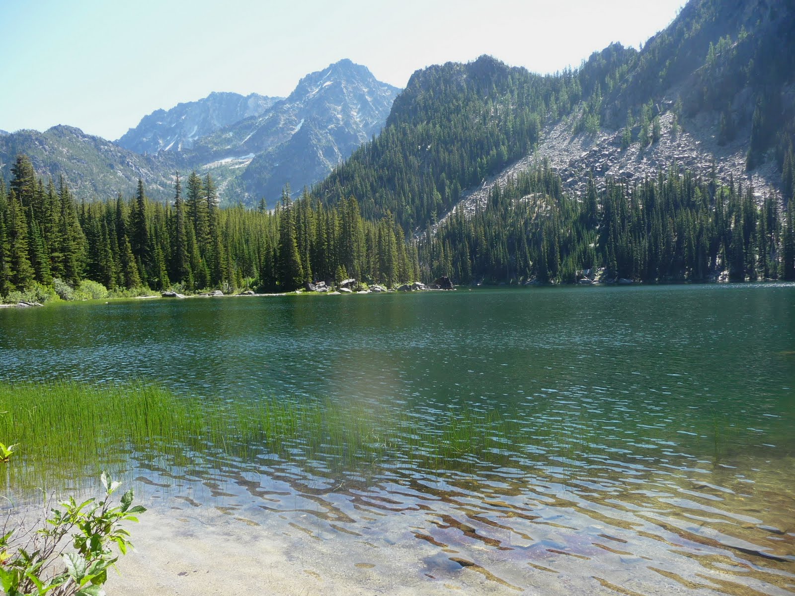
In 4-1/2 miles Stuart Lake (5,075 feet) comes into view; here a path follows the north shoreline with inviting campsites and niches for lunch spots. Most of the campsites were occupied; a large day-use area has been posted “no camping”. If you can’t find a niche beside the lakeshore the day-use site has plenty of room for day-hikers with good views of the lake, surrounding peaks – the sandy reed-lined shoreline also provides opportunities for wading. Bring a map to identify the peaks visible from Stuart Lake including Mount Stuart, Sherpa Peak, Argonaut Peak and Colchuck Peak.
You can explore the trail further as it parallels the lakeshore – here and there rock outcroppings perch above the lake for better views of the peaks. A rough fisherman’s path continues, climbing to Horseshoe Lake where there are purportedly better views of Mount Stuart.
To get there: from the west end of Leavenworth turn onto Icicle Creek road, drive 8.4 miles then turn left onto FS Road No. 7601, continue 4 miles on gravel road to the designated trailhead and facilities (3,389 feet elevation). Fill out a day-use wilderness permit provided at the trailhead before setting out and you’ll also need to display a Northwest Forest Pass.
If you’re hungry after the hike stop at The South Restaurant in Leavenworth for Latin-infused cuisine (hot, hot, hot!) and/or cold drinks. The restaurant is on Front Street in Leavenworth, a block off US 2.
Stats: The hike is 10.5 miles round trip with about 1,850 feet of elevation gain (including ups and downs). The maps are Green Trails No. 209 Mount Stuart and Green Trails No. 177 Chiwaukum Mountains.
For additional information, rules, regulations and current conditions contact Okanogan-Wenatchee National Forest (Leavenworth) at 509-548-6977 or visit their website at www.fs.fed.us/r6/wenatchee

No comments:
Post a Comment